37th International Conference on Coastal Engineering
 Every other year, coastal engineers from around the world gather to exchange ideas, network, and even have a little fun. The International Conference on Coastal Engineering (ICCE) is the premier coastal engineering conference held biennially under the auspices of the Coastal Engineering Research Council of Coasts, Oceans, Ports & Rivers Institute (COPRI). It’s been four years since the last face-to-face conference, and we are excited to have had not one, and not two, but THREE papers accepted for oral presentation at this year’s conference! The theme this year is “The Present State of the Art and Science of Coastal Engineering”. The three papers we’re presenting are described briefly below.
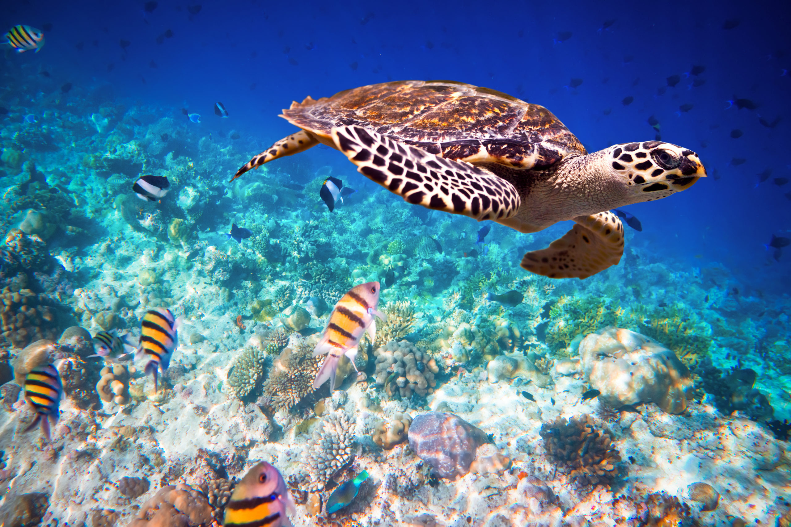
“Rock armour: a benthic habitat providing valuable ecosystem services in the Caribbean Sea” – The paper describes our findings from ecological surveys at several shoreline and beach enhancement projects in the Caribbean over the past 25 years. Using standard fish abundance and diversity surveys and benthic habitat mapping protocols, we track how rock armour transitions from a barren substrate at installation to a diverse marine ecosystem over time. The ecosystem services provided by the rock armour have been evaluated and compare well with naturally occurring habitats. Using available economic benefit analyses, we estimate the value of these ecosystem services at various stages as the rock armour habitat matures.
“Application of historical data from satellite imagery to improve understanding of complex nearshore dynamics” – Collection of nearshore data such as bathymetry and benthic surveys are a requirement to all coastal projects. Typically, surveys are conducted in advance of a modelling exercise to replicate in-situ and existing conditions. These surveys only show one snapshot in time and don’t represent conditions that are out of equilibrium from either seasonal or long-term changes. In these locations, an assessment of a timeseries of surveys would benefit the understanding of nearshore coastal dynamics. However, timeseries of nearshore data are seldom available. Traditional coastal survey technology, e.g., bathymetry from acoustic means or airborne lidar, are expensive and time consuming, and are rarely done on a regular basis. Satellite data offers a novel solution by allowing access to very high-resolution data generated over a 20-year period and stored in easily accessible archives. This paper describes how historical satellite data can be used to understand coastal change to a dynamic sand spit feature on the island of Tobago, in the south-eastern Caribbean.
“Coastal setback practices in the Caribbean and other SIDS: a tool for enhancing resilience” – This paper examines and compares existing coastal setback policies in use throughout the Caribbean and in other small island developing states globally and considers recent climate change predictions. Recommendations are made for a science-based approach to applying setbacks, which incorporates elements of climate change predictions and longer-term observations. Finally, we present a case-study comparing the most promising coastal setback approaches and the observed incursion of storm waves at a coastal community in Jamaica during a major hurricane in 2004 (Hurricane Ivan – In Jamaica: 17 killed and US$575 million in damages).
Interns
We have taken on six interns for the summer to work on a variety of research topics. These include the refinement of an existing in-house hurricane prediction model, the development of a mobile app that will allow our staff to easily recall previous projects and work done at locations throughout the Caribbean, and the development of a database of wave measurement buoys suitable for Caribbean applications. We are constantly investing in new talent to create the next generation of excellent engineers.
Design/Build Projects
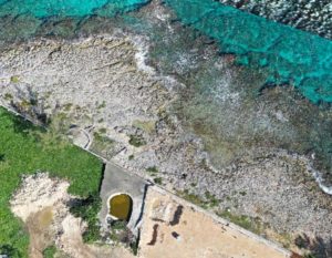
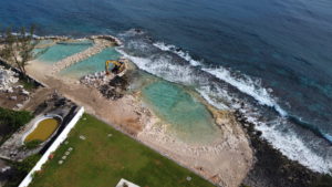
We currently have two beach creation projects in full swing on Jamaica’s north coast. One of them, in Mammee Bay, involves excavating ironshore (beach rock) to create two swimming lagoons with beaches. Breakwaters will be built to shelter the new beach coves from incoming waves, and eventually the crevices in the structures will become a habitat for fish, corals and other marine creatures. We have also seen on earlier beach creation projects where sea turtles use the newly created beach areas for nesting, where previously they could not have accessed the shore.
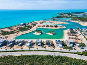
In the Turks and Caicos Islands work is ongoing at the South Bank residential resort and marina. South Bank is a new and vibrant Caribbean destination, with a stunning mix of fully managed properties and facilities. Through our joint venture partnership (Coastal Marine Design Build) with CMS, we are creating dredged swimming lagoons, marina, boat docks and access channel. The swimming lagoon, with beaches all around it, includes two islands with gym, spa and beaches for lounging.